You are here
What are agents of gradation?
What does “gradation” mean?
Gradation
levelling out
Agents
natural forces
↓
Natural forces that wear down high land and fill low land, smoothing the surface over time.
| Agent | What it does | Landform it makes |
|---|---|---|
| Running water | Erodes and deposits | Valleys, deltas |
| Waves | Shapes the coast | Beaches, cliffs |
| Glaciers | Ice carves the land | U-shaped valleys |
| Wind | Moves sand about | Yardangs, dunes |
| Underground water | Dissolves rock | Caves, sinkholes |
The five agents of gradation
- All five agents lower the high places and fill the low places .
- Slowly, they smooth the Earth’s surface.
How does running water shape the land along a river’s course?
![2.6 Agents of Gradation - Shaping of the Earth’s Surface - [Teachoo] - Concepts](https://cdn.teachoo.com/0fc2dfbd-d970-470e-a8f5-371d8fe636bb/fig.-2.10-waterfall-shown-clearly-as-a-river-dropping-vertically-over-a-rock-edge..jpg)
What does a river make along its course?
A river
changes along its course
1. Upper course
Steep, fast and erosive
Example:
V-valley, waterfall, rapids
2. Middle course
River bends and slows
Example:
Meander, oxbow lake
3. Lower course
Slow; drops sediment
Example:
Delta, levee, floodplain
Definition — Waterfall
A waterfall is a place where a river drops over a steep cliff or vertical fall.
It forms where hard rock resists erosion but softer rock below is worn away.
It forms where hard rock resists erosion but softer rock below is worn away.
Fig. 2.10 — A waterfall
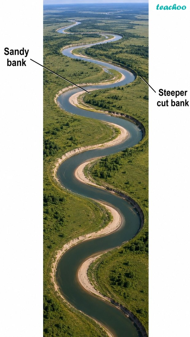
Definition — Meander
A meander is a winding curve or bend in the middle or lower course of a river.
The river erodes the outer bank and deposits sediment on the inner bank.
The river erodes the outer bank and deposits sediment on the inner bank.
Fig. 2.11 — A meander
Definition — Delta
A delta is a fan-shaped or triangular area of land at the mouth of a river.
It forms as the river drops the sediment it carried, and is very fertile.
It forms as the river drops the sediment it carried, and is very fertile.
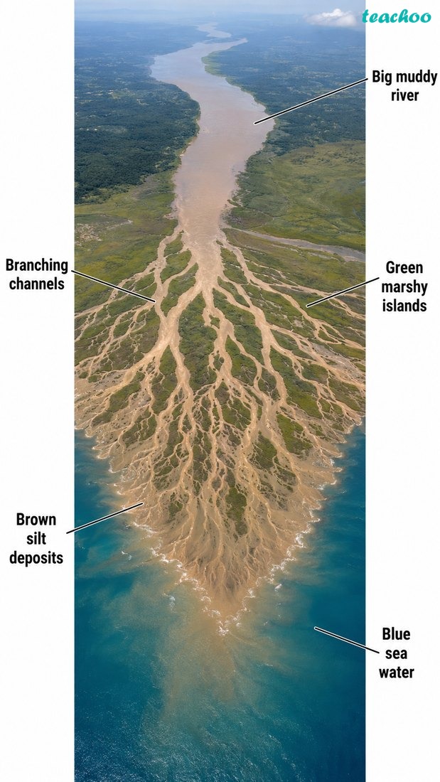
Fig. 2.12 — A delta at the mouth of a river
🔎 Let’s Explore
Have you heard about the
Sundarbans delta
? Find out what makes it unique and why it draws so many tourists.
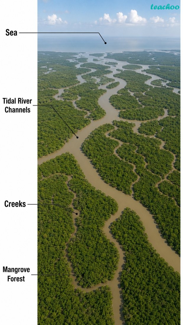
Fig. 2.13 — The Sundarbans delta
How do waves and currents shape the coast?
What landforms do sea waves create?
Sea waves
work along the coast
1. By deposition
Waves drop sediment
Example:
Beach, sand bar
2. By erosion
Waves wear the coast
Example:
Cliff, cave, arch, stack
Definition — Beach
A beach is a strip of sand, pebbles or rock along the shoreline.
It is built by waves depositing sediment along the coast.
It is built by waves depositing sediment along the coast.
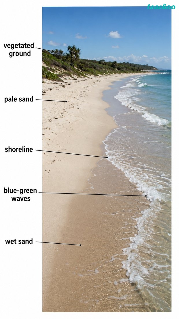
Fig. 2.14 — A beach, built by waves depositing sand
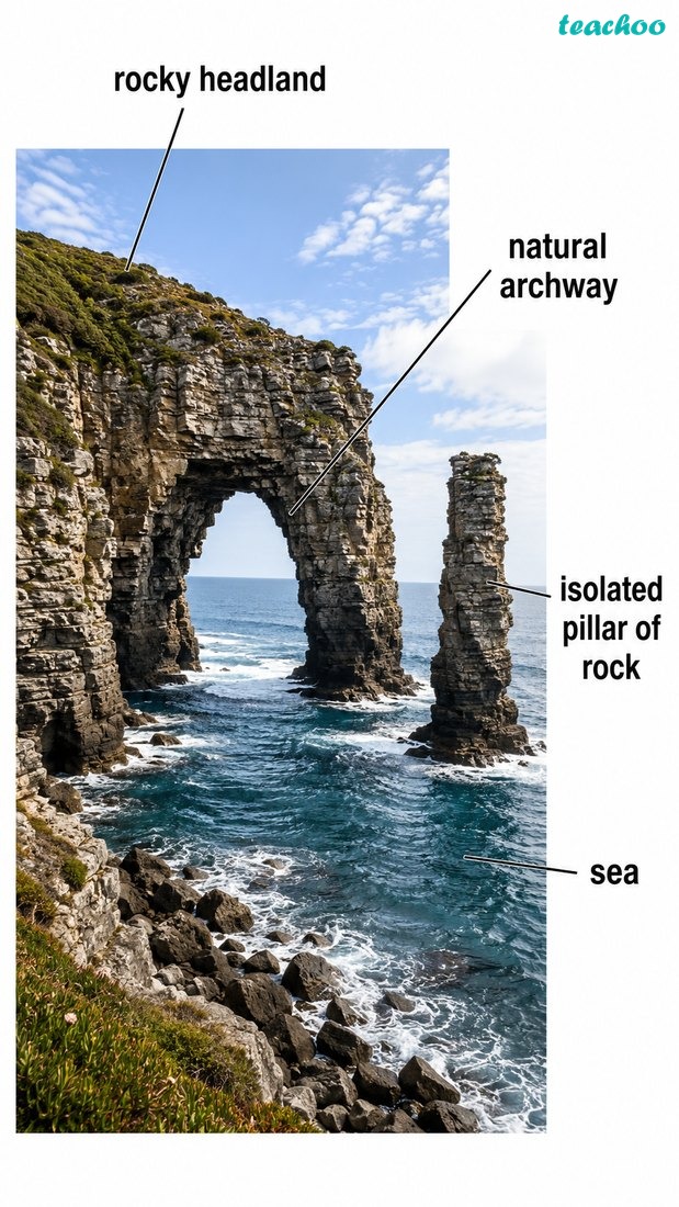
Fig. 2.15 — A sea arch and a sea stack
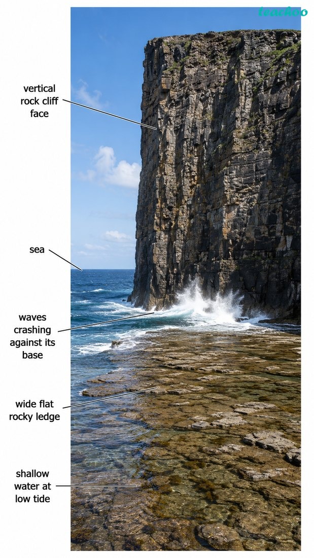
Fig. 2.16 — A sea cliff and a shore platform
How do glaciers shape the land?
What landforms do glaciers create?
A glacier
a slow river of ice
1. By erosion
Ice carves the valley
Example:
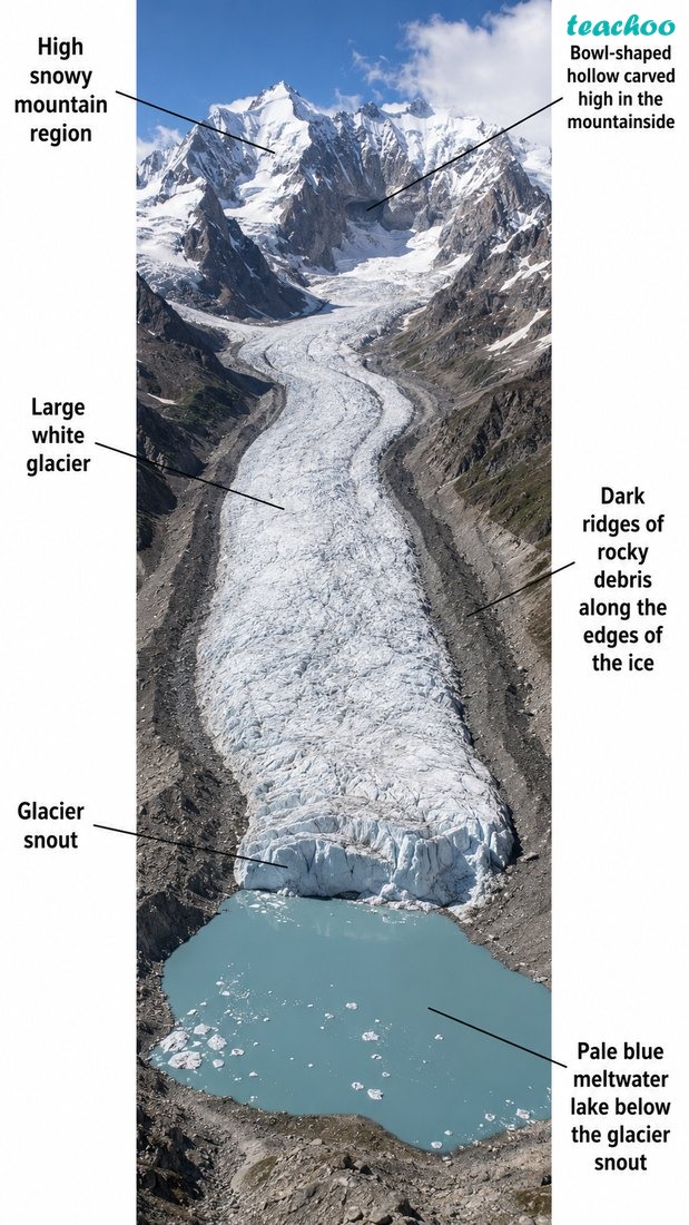
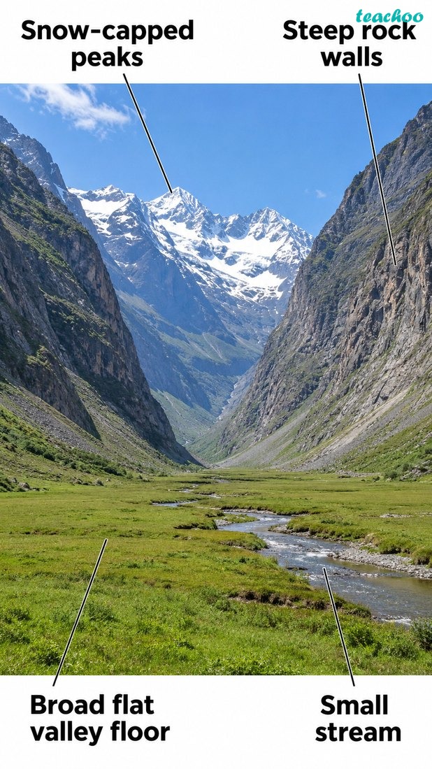
U-valley, cirque, arete, fjord
2. By deposition
Ice drops rock debris
Example:
Lateral, terminal, medial moraine
Fig. 2.17 — Glacial landforms in a snowy mountain setting
Fig. 2.18 — A U-shaped valley carved by a glacier
Definition — Moraine
A moraine is rock, soil and debris (till) carried and left behind by a glacier.
It is deposited when the glacier melts.
It is deposited when the glacier melts.
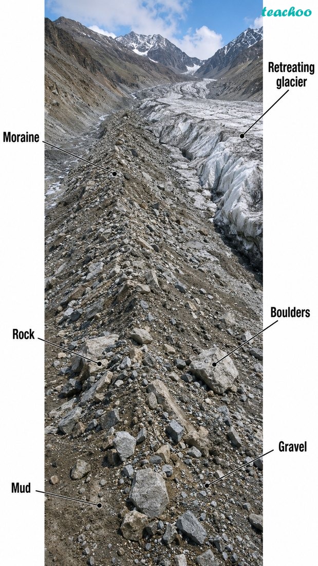
Fig. 2.19 — A moraine, left behind by a melting glacier
💭 Think About It
A devastating flood struck the
Chamoli
district of Uttarakhand in February 2021. Many people and livestock were lost, and roads, bridges and hydel projects were damaged. Can you find out what caused this sudden flood?
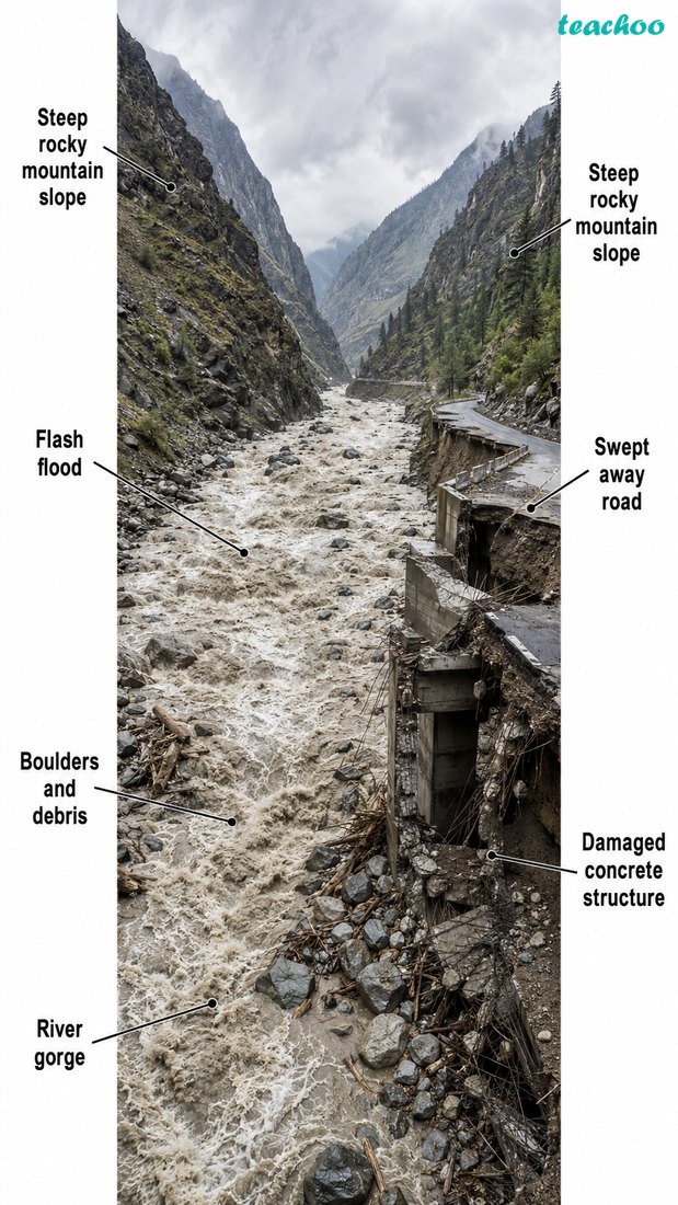
Fig. 2.20 — The Chamoli flood disaster, Uttarakhand (2021)
How does wind shape the desert?
What landforms does the wind create?
The wind
shapes dry, sandy land
1. By erosion
Wind wears the rock
Example:
Yardang, deflation hollow
2. By deposition
Wind piles up sand
Example:
Barchan, star, parabolic dune
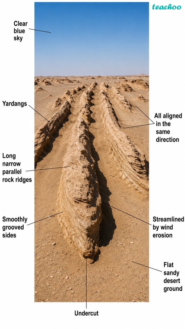
Fig. 2.21 — A yardang, shaped by wind erosion
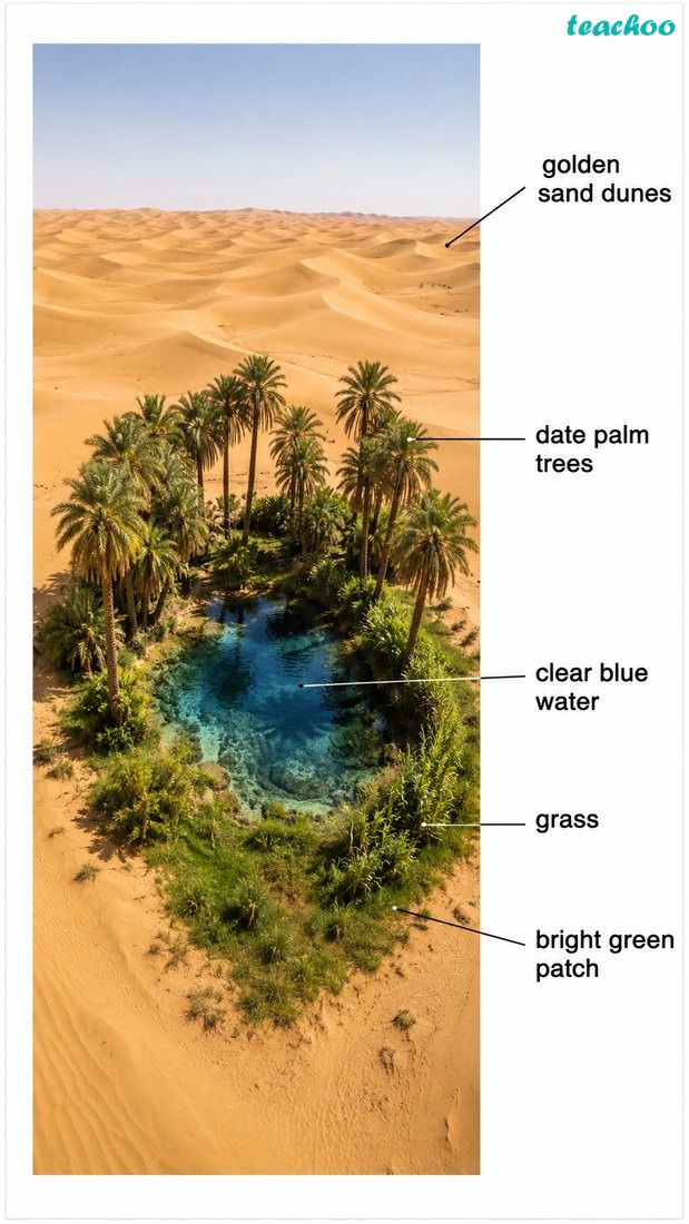
Fig. 2.22 — An oasis in a desert
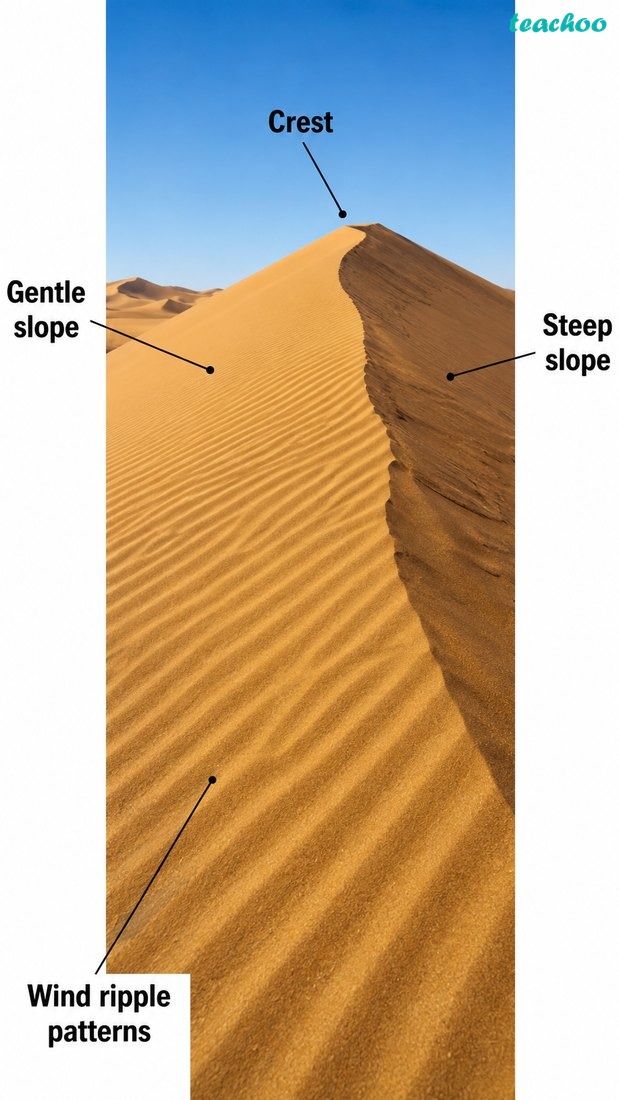
Fig. 2.23 — Sand dunes, built by wind deposition
How does underground water shape the land?
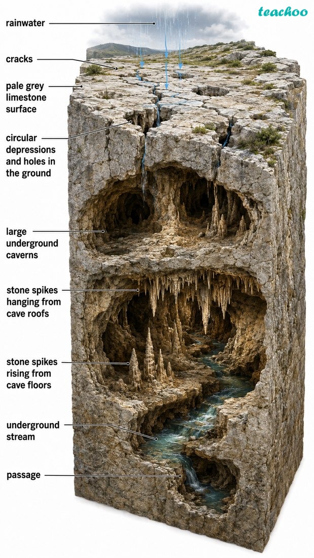
What is karst topography?
Karst
soluble rock land
Water
dissolves it
↓
The special landscape of caves and hollows made where underground water dissolves limestone.
Karst topography — the landscape formed where underground water dissolves limestone
What does underground water create?
Underground water
dissolves soft rock
1. It builds up
Minerals slowly deposit
Example:
Stalactite, stalagmite, pillar
2. It hollows out
Water dissolves the rock
Example:
Cave, sinkhole, underground river
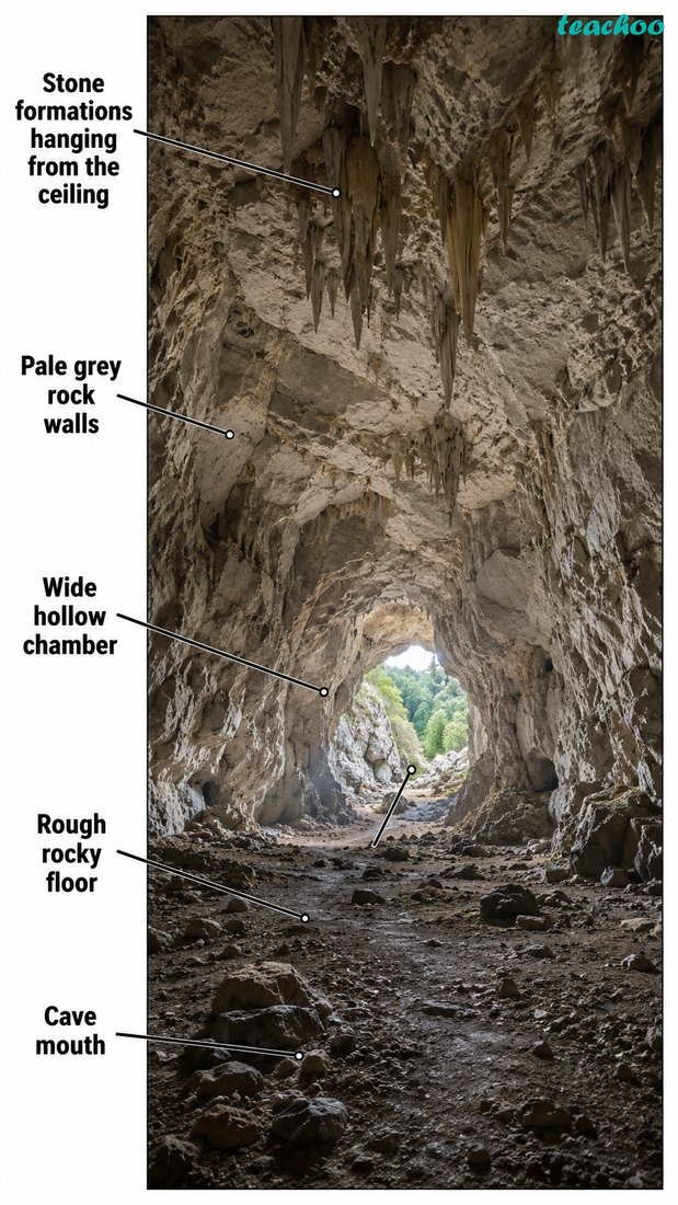
Fig. 2.24 — A cave hollowed out of soluble rock
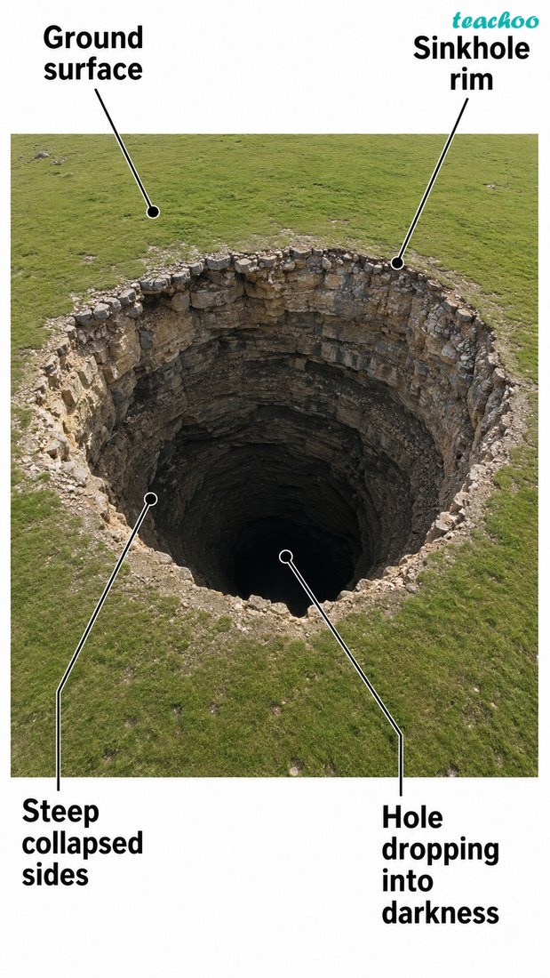
Fig. 2.25 — Sinkholes formed by underground solution
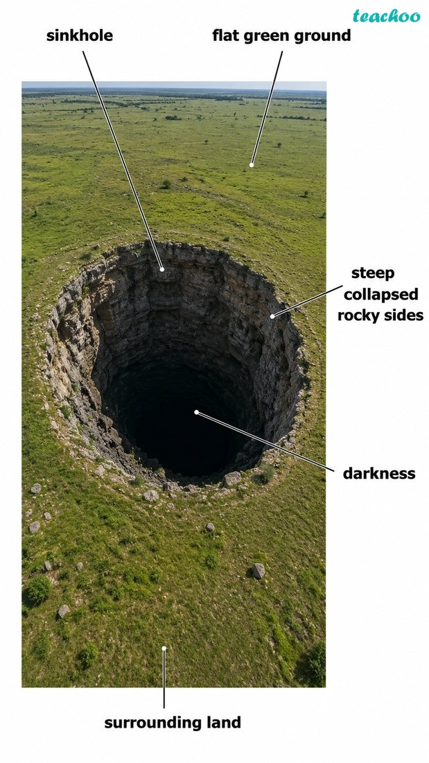
Fig. 2.26 — An underground river
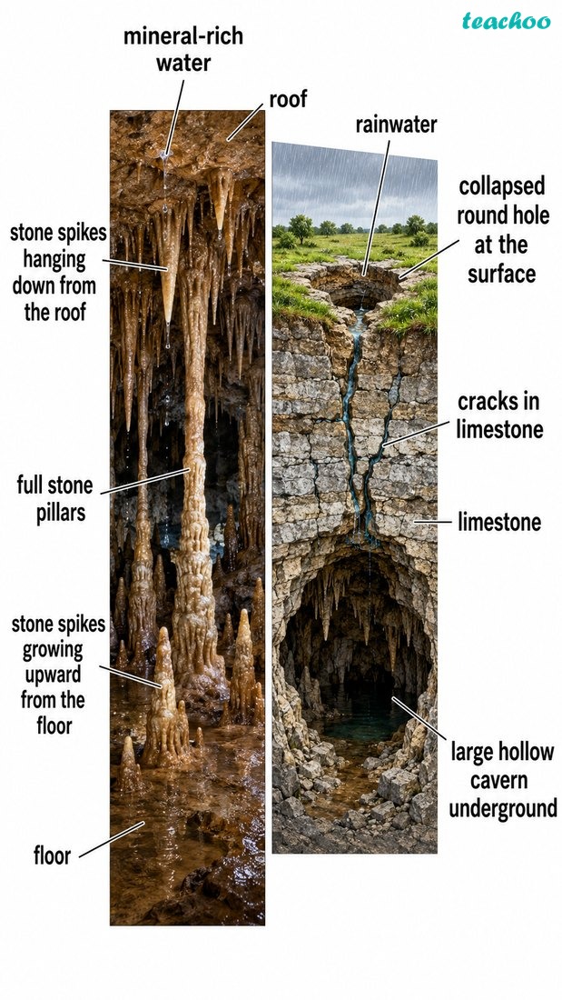
Underground water at work — it builds stalactites, stalagmites and pillars, and it hollows out caves and sinkholes
🔎 Let’s Explore
Observe the landforms around your school or home and try to identify which
agent of gradation
may have created each one.
Related NCERT Questions — try them now
NCERT Question 5 — Draw and label a meander and a delta
Draw and label a diagram of a meander and a delta.
NCERT Question 9 — Prepare a model of landforms
Prepare a model of landforms created by underground water.
NCERT Question 12 — Create a poster showing landforms
Create a poster showing landforms that are considered to be sacred or important in your region, and add the folk stories associated with them.
NCERT Question 15 — Divide the class into three groups
Divide the class into three groups. Each group will work on one project (water, wind, and glacier). The project should highlight the causes, impact on human life and the environment, and mitigation measures.