Last updated at February 24, 2026 by Teachoo
Transcript
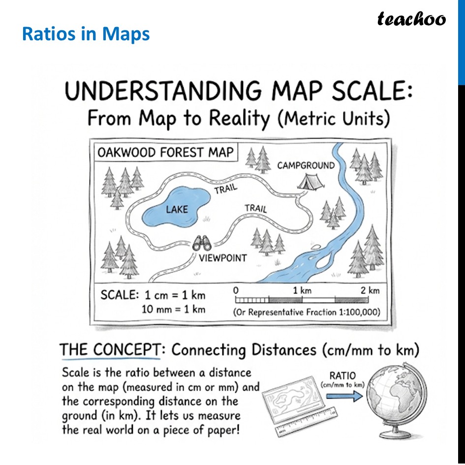
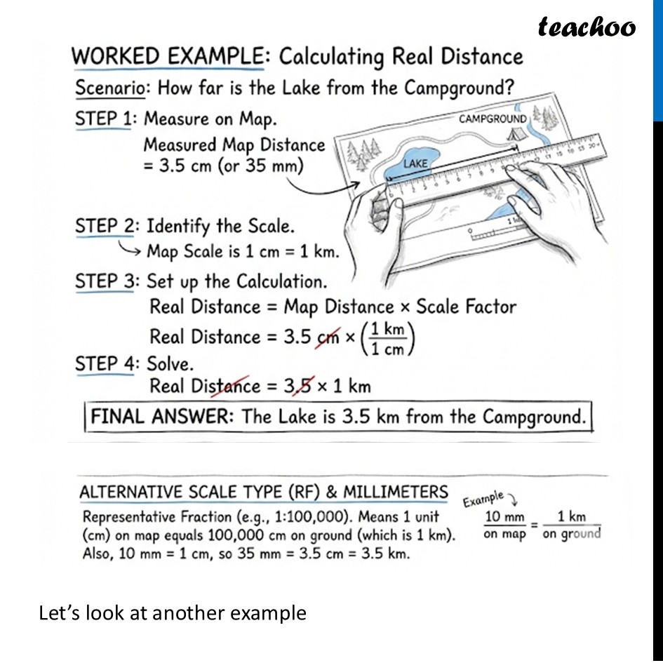
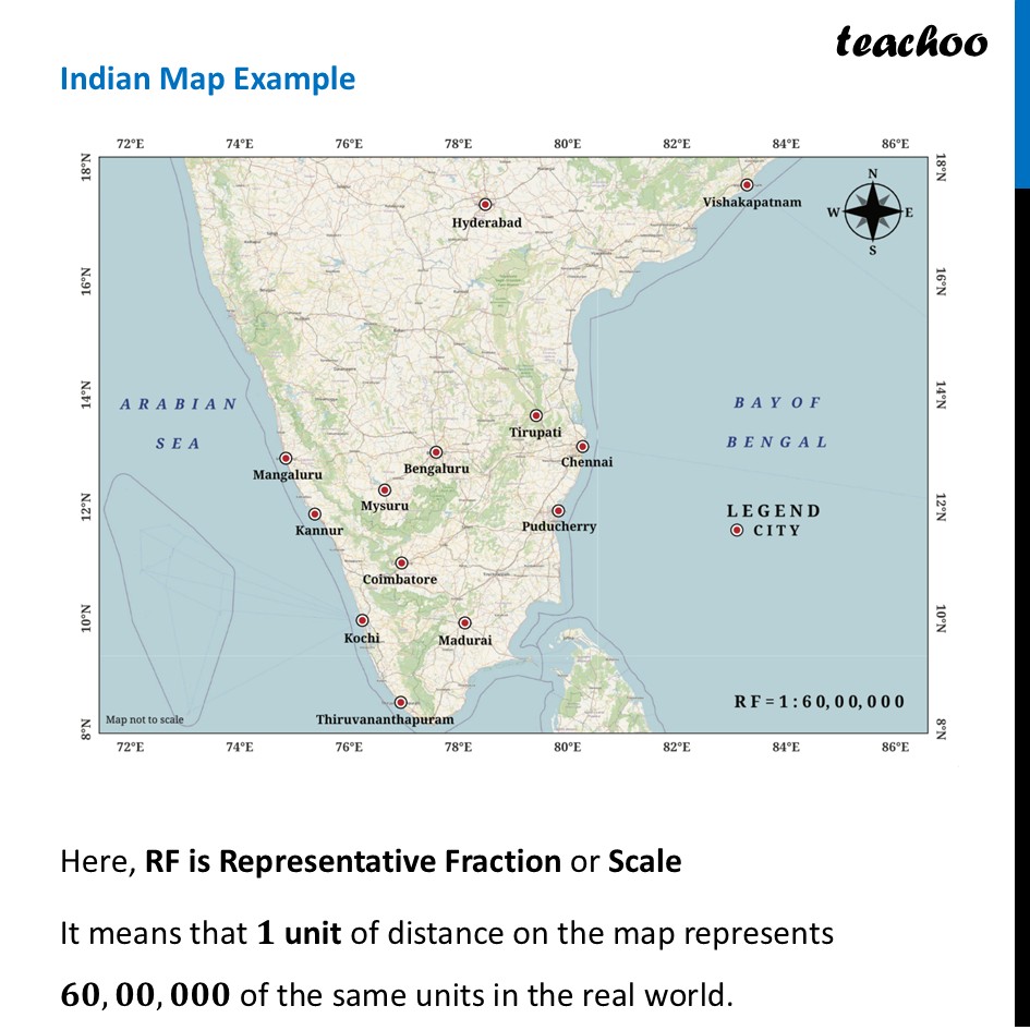
Ratios in MapsUNDERSTANDING MAP SCALE: From Map to Reality (Metric Units) THE CONCEPT: Connecting Distances ( to km ) Scale is the ratio between a distance on the map (measured in cm or mm) and the corresponding distance on the ground (in km). It lets us measure the real world on a piece of paper!WORKED EXAMPLE: Calculating Real Distance Scenario: How far is the Lake from the Campground? STEP 1: Measure on Map. Measured Map Distance (or 35 mm ) STEP 2: Identify the Scale. → Map Scale is . STEP 3: Set up the Calculation. Real Distance Map Distance × Scale Factor Real Distance STEP 4: Solve. Real Distance FINAL ANSWER: The Lake is 3.5 km from the Campground. ALTERNATIVE SCALE TYPE (RF) & MILLIMETERS Example ↓ Representative Fraction (e.g., ). Means 1 unit (cm) on map equals on ground (which is 1 km ). Also, , so .Let’s look at another example Indian Map Example Here, RF is Representative Fraction or Scale It means that 𝟏 unit of distance on the map represents 𝟔𝟎,𝟎𝟎,𝟎𝟎𝟎 of the same units in the real world. For example 1 centimetre on the map equals 60,00,000 centimetres on the actual ground. Now, let’s actually find distance between two cities